Viewing Yutengping Iron Bridge: How to Tell the Old and New Bridges Apart
The red-brick ruin and its neighboring iron bridge are different engineering projects from different periods; compare them from a safe viewpoint.
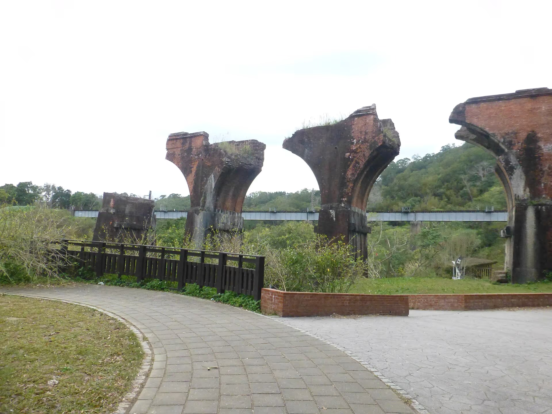
Location
Sanyi Township, Miaoli County
Topic
Bridge comparison
Navigation
Confirm destination
Before visiting
Check access notices
Separate two structures
Identify surviving brick piers and later steel girders, then consider how an earthquake changed the railway's alignment.
Expect different views
Different viewpoints reveal different sections; never climb, cross barriers or enter unopened railway tracks.
Protect the site
Use only authorized viewing areas.
How to view Yutengping Iron Bridge
The broken brick bridge and the later iron bridge belong to different engineering periods. From a suitable angle, their differences are easy to see.
What to identify first
Find the surviving red-brick piers, then the newer steel structure. Their relationship helps explain the post-earthquake railway diversion. Not every viewpoint includes every section.
Safety on site
High ground and bridge surroundings have access restrictions. Never climb the structure, cross a barrier or enter closed track areas.
Frequently asked questions
Can I walk onto the iron bridge? Follow operating and access rules. A photo viewpoint does not automatically make a bridge a public pedestrian route.
Does the brick ruin require a ticket? Outdoor viewing is separate from the ticketed rail bike.
Where should I navigate? This guide concerns Yutengping Iron Bridge. Check its name and county in the dedicated Google Maps search, as no fixed Place ID is available here. Enter Longteng Bridge separately if visiting the brick ruins.
Further reading
Why both bridges stand in one valley
The original brick bridge was damaged in the 1935 earthquake, while the later steel-girder bridge reflects a subsequent engineering response. Comparing materials and forms connects the histories of disaster, rerouting and preservation.
Three steps for observing
First identify the red-brick arch remains; second compare steel girders with the piers; third study the valley to understand why railways needed large bridges. A given viewpoint may show only part of this sequence.
Photographs and safe distances
A medium focal length can frame brick and steel bridges together to highlight their different eras. Whether anyone may access the bridge deck is a management decision, not a photographer’s choice.
Explore the location from different angles
Plan your visit with Google Maps
Remains of Longteng Bridge (龍騰斷橋/魚藤坪斷橋)
Yutengping Iron Bridge Sanyi Miaoli Taiwan
For official tourism information see Taiwan Tourism Administration (official tourism portal) . Map pins, reviews and business information change over time; follow road signs and on-site guidance for parking and walking routes.
Read next
- Seasons and climate Longteng Bridge Through the Seasons: Weather, Stream Conditions and Wildlife An overview of twelve months of typical temperatures, rain, humidity, creek conditions, wildlife and what to wear along the Old Mountain Line.
- Visitor services Longteng Bridge Visitor Facilities: Toilets, Parking, Food and Supplies Plan for toilets, parking, food, stays, convenience stores, fuel, EV charging, medical help, mobile reception and accessible family facilities along the Old Mountain Line.
- Science and responsibility Why Did Longteng Bridge Break? Earthquake Engineering and Visitor Responsibility Understand how brick arches failed in the 1935 earthquake and why protecting the remains and their wildlife habitats matters.