History of Yutengping Broken Bridge: Earthquakes and a Red-Brick Railway
Longteng Bridge is striking because a once-complete engineering work was interrupted by an earthquake. Its brick arches, neighboring steel bridge and valley preserve different solutions to the challenges of mountain railways.
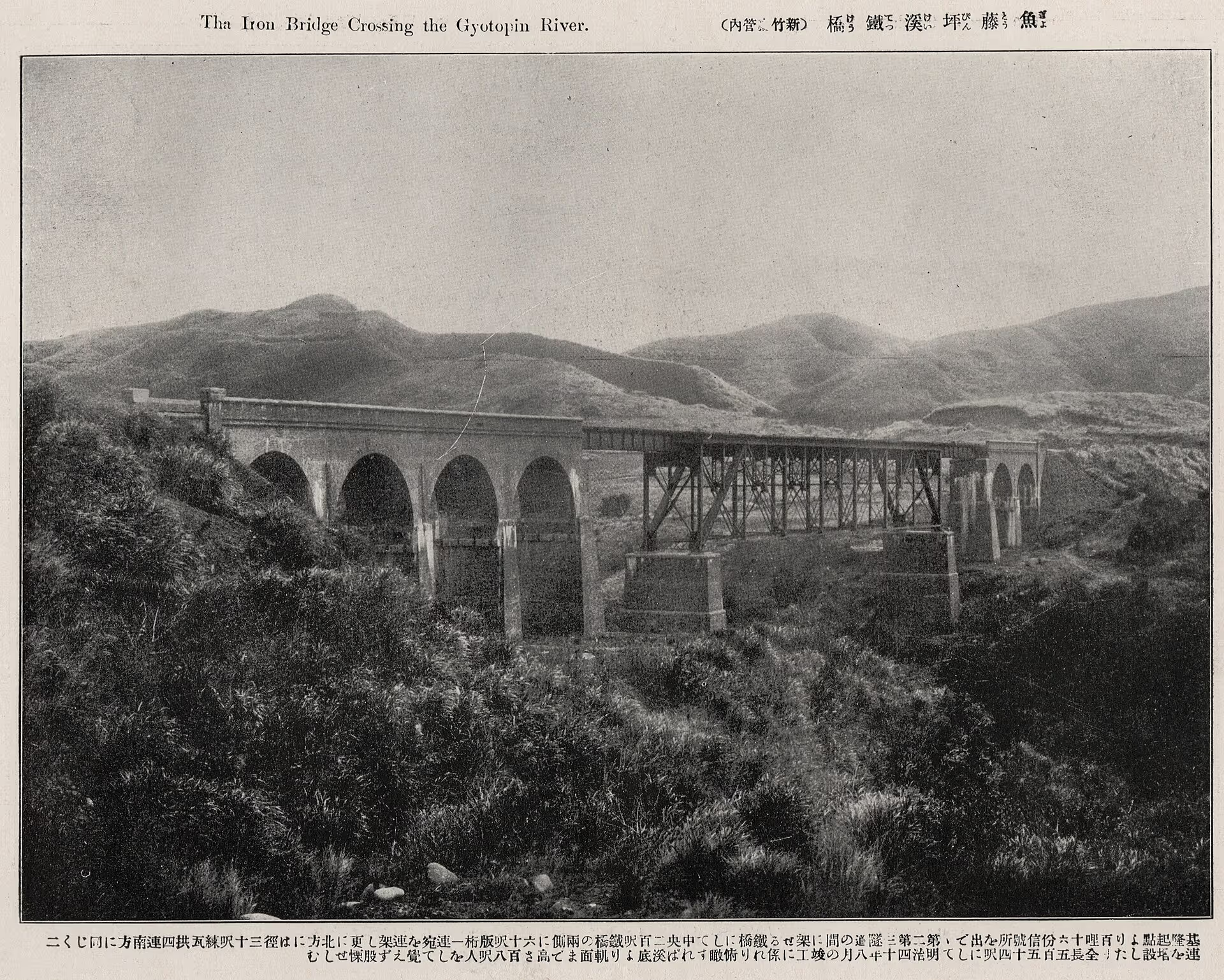
Original name
Yutengping Bridge
Completed
1907
Earthquake damage
1935
Heritage status
Miaoli County historic monument
Red-brick arches
Masonry piers and arches carried the mountain railway across the valley.
Earthquake damage
The Guandaoshan earthquake broke the bridge's original continuity.
Replacement iron bridge
A western alignment created the two-bridge landscape visible today.
Three eras in one valley
The clearest way to understand Longteng Bridge is to see three overlapping periods:
- The brick bridge era (1907–1935): Yutengping Bridge crossed the valley with red-brick arches, one of the Old Mountain Line’s most conspicuous engineering works.
- The broken bridge and replacement era (1935–1998): The earthquake shattered the original structure; a steel-girder bridge to the west kept rail transport operating while the old arches became ruins.
- The heritage era (1998–present): The old line ceased regular service, the ruined bridge became a designated monument, and portions of the railway reopened for tourism in the late 2010s.
These three periods remain visible side by side, making the site especially valuable.
1907: Completion of Yutengping Bridge
The bridge was a major part of the Old Mountain Line, built to span a steep valley. Its brick piers and arch rings were representative of early railway construction and remain the defining visual feature today.
The railway wound through the Miaoli hills, climbing amid frequent tunnels and bridges. Uneven terrain, little available space and the lack of large modern machines made construction difficult. Workers transported materials using human labor and light temporary rail systems; masonry piers had to be built layer by layer within the valley.
Brick arches were consequently not only an aesthetic choice but also a practical response to the era’s construction conditions. Brick was comparatively accessible, masonry could be built on site, and arched forms could span the required openings—a mature solution in early twentieth-century Taiwan.
1935: The Guandaoshan earthquake
The 1935 earthquake devastated parts of central Taiwan and fractured Yutengping Bridge in the affected area. The damaged structure could no longer carry trains in its original configuration. Its northern and southern sections remained as fragments on opposite sides of the valley.
The epicentral area is commonly associated with Sanyi and Guandaoshan. Often reported at approximately magnitude 7.1, the event is also called the Hsinchu–Taichung earthquake and ranks among Taiwan’s most destructive modern earthquakes. It also marked local memory and place names: over time, “Yutengping” gave way to “Longteng,” suggesting the auspicious image of a soaring dragon and leaping tiger.
The masonry failure illustrates how an arch depends on compressive forces. When earthquake shaking displaces a pier, the arch joints can open. The fractures visible today bear witness to this mechanism. Read earthquake engineering and visitor responsibility for more detail.
1936–1938: A new iron bridge to the west
To restore railway transport, engineers built Yutengping Iron Bridge on a different alignment to the west rather than simply rebuilding the original brick bridge. This is the steel structure visible behind the red-brick ruins in many photographs.
Steel-girder bridge technology and material supply had matured by the 1930s. The new approach could offer practical advantages in construction speed, span and seismic performance, particularly in an earthquake-affected valley. This was an engineering response to new circumstances rather than merely a failure to repair the original.
1998: The Old Mountain Line stopped regular service
Taiwan Railways moved the Sanyi–Houli section onto a new alignment in 1998. The former mountain line stopped carrying regular trains, and sites such as Shengxing and Old Tai’an stations lost their original transport roles.
Without routine trains, bridges, tunnels and stations became a nearly continuous historic railway landscape. Longteng’s role shifted from transport infrastructure to a heritage ruin people could visit and interpret. Shengxing Station sits at an elevation of approximately 402 meters, the highest point on the old line, illustrating why bridges and tunnels were essential in this steep terrain.
1999: Another earthquake left its mark
The September 21 (Jiji) earthquake also affected the historic remains. Reinforcement and protective elements visible today reflect the need not only to preserve appearance but also to prevent continuing deterioration.
2003: Designation as a county historic monument
The site was designated for its railway engineering, earthquake history and brick construction. Its formal heritage name is Yutengping Broken Bridge; Longteng Bridge remains the name widely used by travelers.
Late 2010s: Railway tourism returned
The Old Mountain Line was not forgotten after closure. Some sections returned as an Old Mountain Line Rail Bike experience, letting visitors travel through tunnels and across bridges at a different pace and, on certain routes, see the direction of the iron bridge and southern ruins.
The change also raised new questions: how to balance crowds and preservation, how narrow hillside roads and parking areas cope with holidays, and whether local communities benefit from tourism. These issues are part of the contemporary story of Longteng Bridge.
What makes the red-brick arches distinctive?
An arch transfers a load outward toward the supports; repeated rings form a rhythm between the deck and piers. The bridge combines brick, stone and associated masonry techniques. As well as its transport role, the structure has a strong architectural character.
The broken state also exposes arch sections, thickness and internal construction details that are harder to observe on an intact bridge.
How to read the history while standing there
First look at the old brick bridge, then toward the steel-girder bridge behind it. These are not “before and after restoration” images of one bridge: they are the original ruins and a post-earthquake replacement. This distinction turns the valley from a photo stop into readable railway history.
Three further observations enrich the visit:
- Place names: The change from Yutengping to Longteng is historical in itself. See local names and legends.
- The mountain: Guandaoshan connects the bridge to the 1935 disaster.
- The environment: Yutengping Creek below belongs to the upstream catchment of Liyutan Reservoir; the ruins are also part of a low-hill ecosystem.
For practical planning, continue to the first-time visitor guide, transportation and parking or a Sanyi day itinerary.
Explore the location from different angles
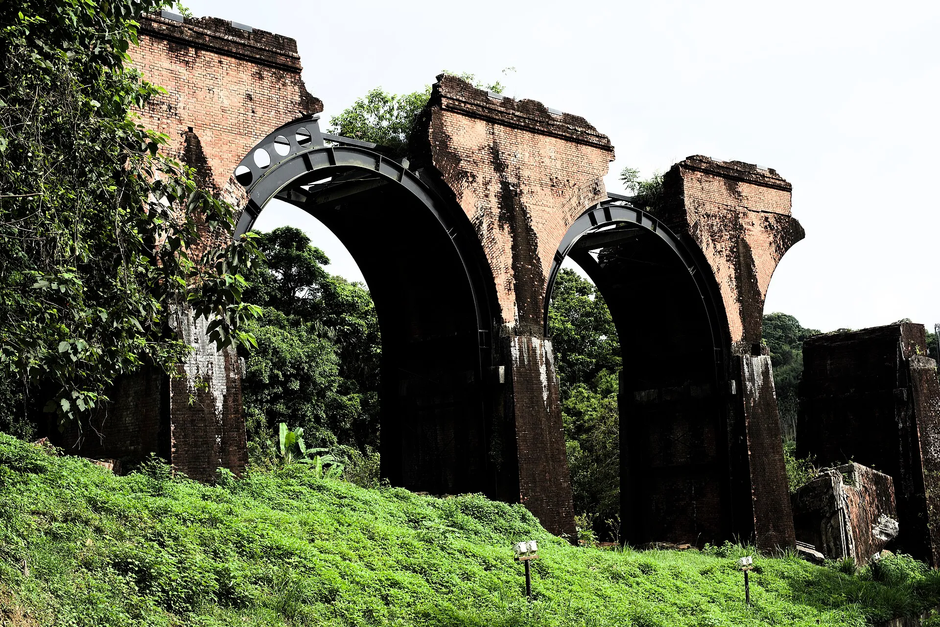
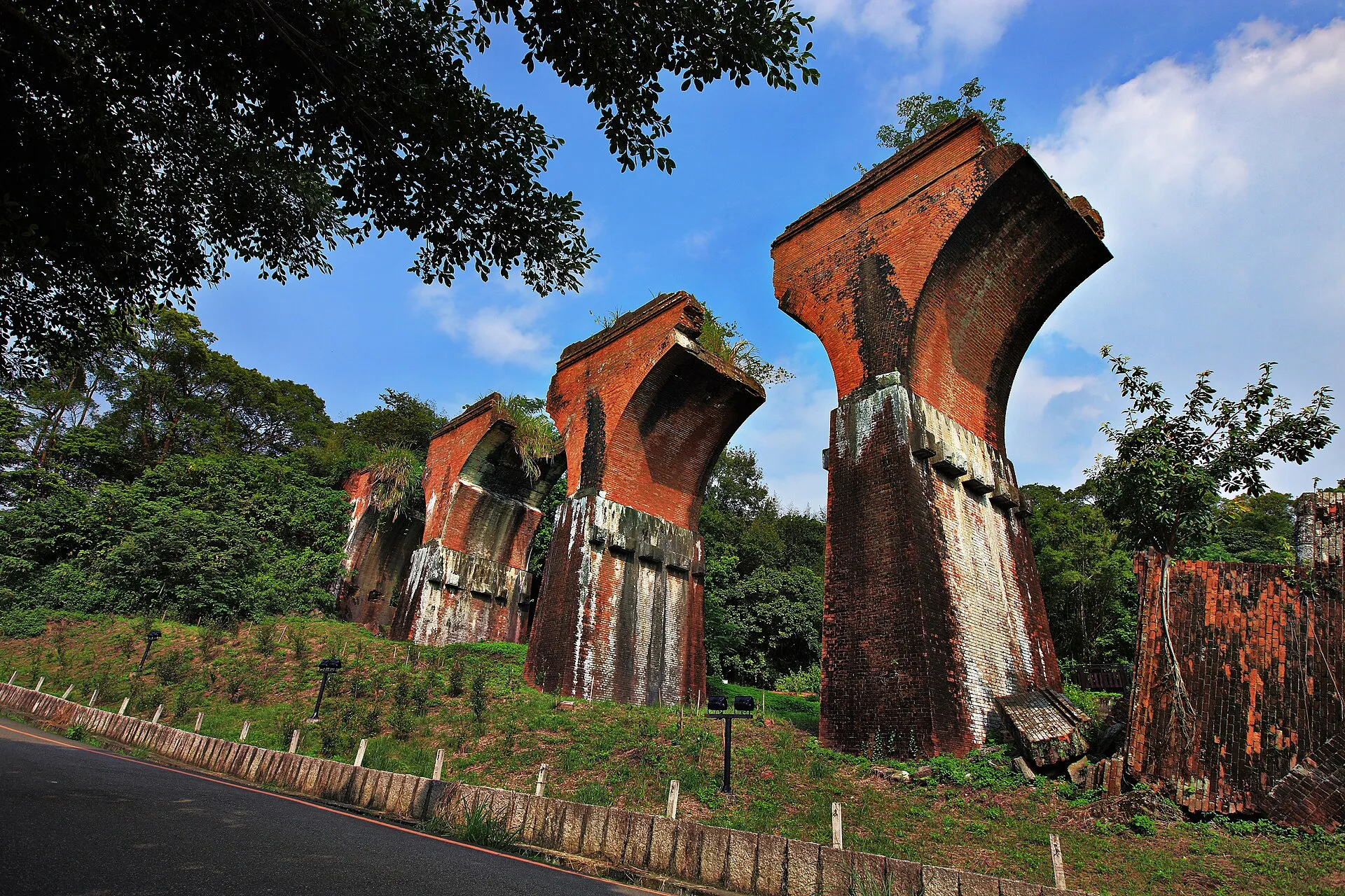
Plan your visit with Google Maps
Remains of Longteng Bridge (龍騰斷橋/魚藤坪斷橋)
Miaoli County Road 49, 367 Sanyi Township, Miaoli County, Taiwan
For official tourism information see Taiwan Tourism Administration (official tourism portal) . Map pins, reviews and business information change over time; follow road signs and on-site guidance for parking and walking routes.
Read next
- Names and local stories Why Is Yutengping Called Longteng? Place Names and Local Legends Explore the origins of Yutengping, the local fish-poison vine account, the name Longteng after 1935, and the line between legend and history.
- Science and responsibility Why Did Longteng Bridge Break? Earthquake Engineering and Visitor Responsibility Understand how brick arches failed in the 1935 earthquake and why protecting the remains and their wildlife habitats matters.
- Yutengping Iron Bridge Yutengping Broken Bridge and Yutengping Iron Bridge Are Not the Same Compare the construction dates, materials, positions and rail bike views of two often-confused bridges.